

Anthony Lomax @ALomax@qoto.org
#Earthquake happenings+tidbits, maps, #MachineLearning... I'm ALomax Scientific: earthquake monitoring and analysis.
"seismicity is only the edges and shadows of complex, 3D space-time tectonic processes"
Car free for daily life since 1976.
Joined Nov 2022
And, since seismicity is only the edges and shadows of complex, 3D space-time tectonic processes, the best is an animated view in 3D!
Anthony Lomax
boosted

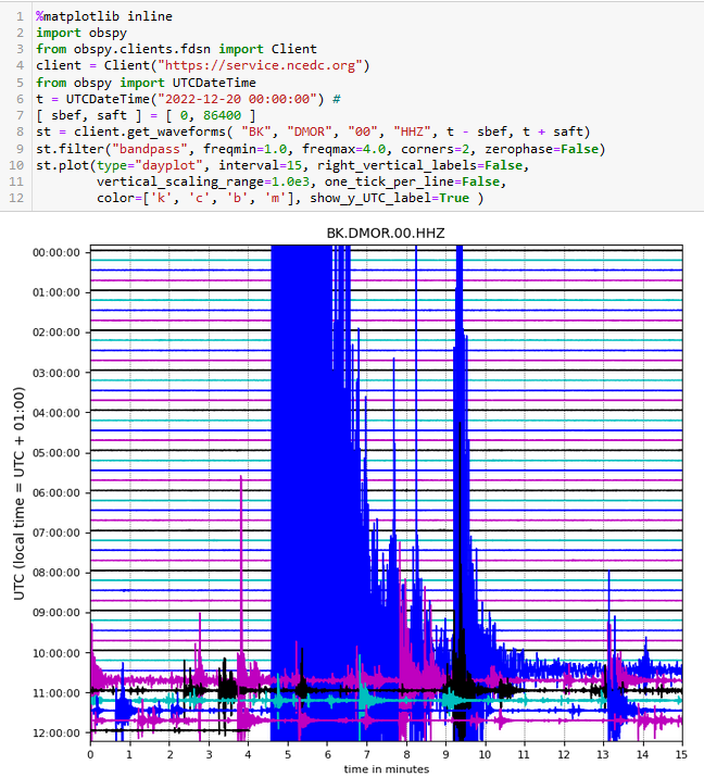
#EarthquakeReport #EarthquakeToot for M 6.4 #Earthquake in Mendocino triple junction (Triangle of Doom) region
aftershocks suggest left-lateral strike-slip in Gorda plate
felt broadly, about 92%g in Ferndale
read more from last year's report
https://earthjay.com/?p=10125
https://earthquake.usgs.gov/earthquakes/eventpage/nc73821036/executive
hi res map here
https://earthjay.com/earthquakes/20221220_norcal/20221220_norcal_interpretation.jpg
High-precision relocations to 2021/12 donw with NLL-SSST-coherence (https://doi.org/10.1029/2021JB023190), past year done with NLL-SSST.
Earthquake arrival data from service.ncedc.org/fdsnws
M6.4 #earthquake near Ferndale, CA: Seismicity for today (red), the past year (orange) and back to 1982 (green-blue-purple). Views from above/south/east. Today's events may be in upper part of down-going, Gorda plate.
Anthony Lomax
boosted

You can see many aftershocks from today's magnitude 6.4 #earthquake in Northern #California
You see the lines are almost flat before the mainshock and then there is #aftershock after aftershock following it. Largest 4.6 but many between 2.5 and 4. This sequence will likely continue for some time.
https://earthquake.usgs.gov/earthquakes/eventpage/nc73821036/executive
Anthony Lomax
boosted

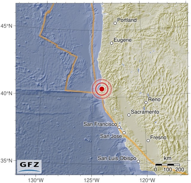
M 6.1, Near Coast of Northern California
2022-12-20 10:34:26 40.62 -124.08 10 km A
http://geofon.gfz-potsdam.de/eqinfo/event.php?from=rss&id=gfz2022yvtn
Anthony Lomax
boosted

Felt good to remove links to my soon-to-be-deleted birdsite account from https://www.leouieda.com and https://www.compgeolab.org today. Since it's against their rules to promote other platforms over there, I figured it's only fair if I don't promote their platform on my websites either.
Anthony Lomax
boosted

In a world of scientific misinformation that can lead to nationwide vaccine refusal, climate change denial, and any number of other problems, we need to do more than train a subset of the population for scientific careers. We need everyone in the country to be fluent in the sphere of science.
Anthony Lomax
boosted

Time ago, the now scary bird site, was useful for science, knowledge building, hazard communication, etc...
We wrote a paper on that: Rapid collaborative knowledge building via Twitter after significant geohazard events.
Anthony Lomax
boosted

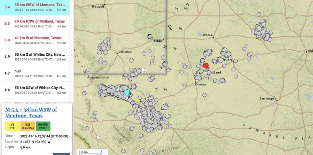
Today's M5.1-5.3 #earthquake near #Midland (red) is located at a few 100 km from the M5.4 event (blue) that happened in Western #Texas one month ago.
(Map generated at https://earthquake.usgs.gov/earthquakes/eventpage/us6000j9vq/executive )
Anthony Lomax
boosted

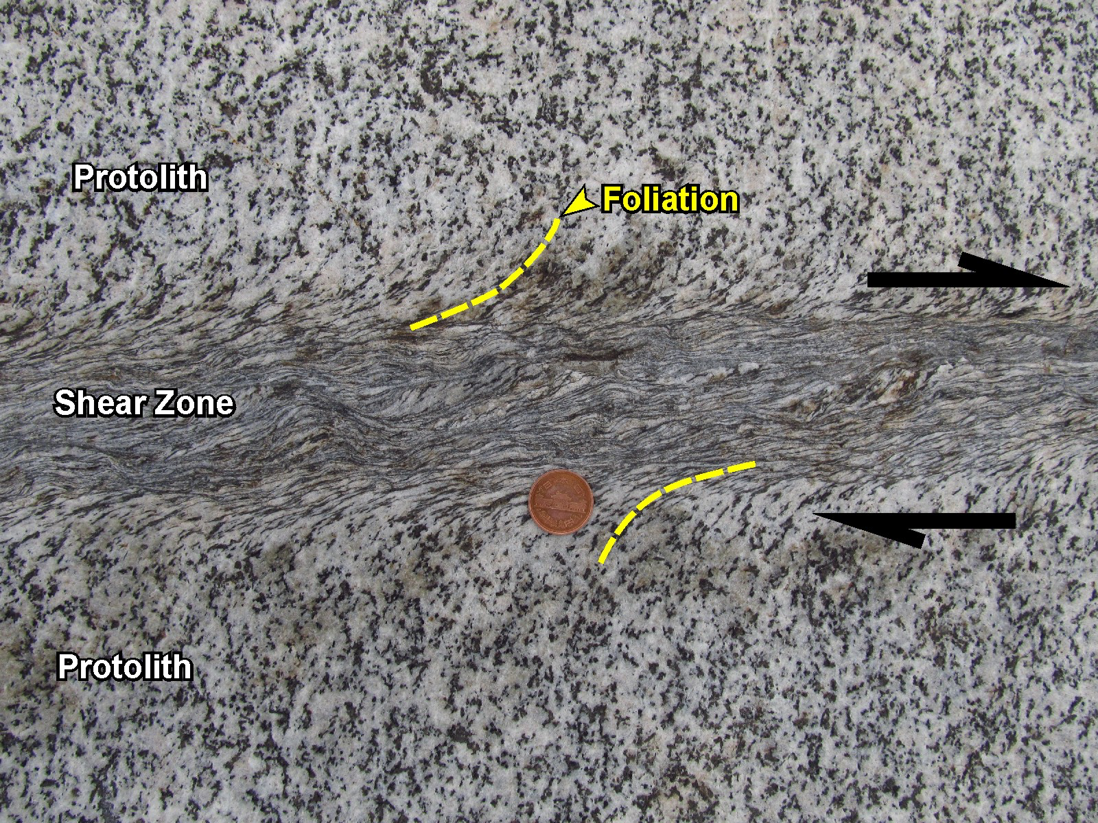
Mylonite
Down in the hot middle to lower crust where temperatures are higher, rocks behave differently. At geologic timescales they can flow, shear, and deform plastically without fracturing under shear stresses that produce strain, and generally do not produce earthquakes. This ductile environment is where the deep fault shear zones are. These zones are generally wider than faults and can accommodate displacements from centimeters to tens of kilometers. Nearby rocks may show little, or no strain at all.
Movement of the shear zones form foliated, deformed, lineated rocks called mylonite, and lab experiments show the fine-grained textures are formed by recrystallization, grain-size reduction, and metamorphic reactions. These textures can provide clues as to the displacement, or the relative movement of the rocks on either side of the shear zones, called shear-sense indicators. In the example shown below, the sense of movement is “dextral” or to the right (to the left is called “sinistral”). Dextral movement has caused “drag” lineations to form on either side of the rock. If you turn the rock upside down in your imagination, the sense of movement is still dextral facing the shear zone.
The shear-sense indicators in rocks are important tectonic clues for structural geologists to determine how mountains formed and plates collided.
More information from EGU Blog authors Samuele Papeschi, Sandra McLaren and Hannah Davies are at the link: https://blogs.egu.eu/divisions/ts/2021/01/25/features-from-the-field-shear-zones-and-mylonites/
More on mylonites here: https://en.m.wikipedia.org/wiki/Mylonite
Photo of metagranite mylonite and interpretation and annotation is by Samuele Papeschi.
#mylonite #ShearZones #ShearSenseIndicators #rocks #geology #ScienceMastodon
Anthony Lomax
boosted
Just posted this 👇🏼 on the scary bird site.
Will see what happens.
Anthony Lomax
boosted

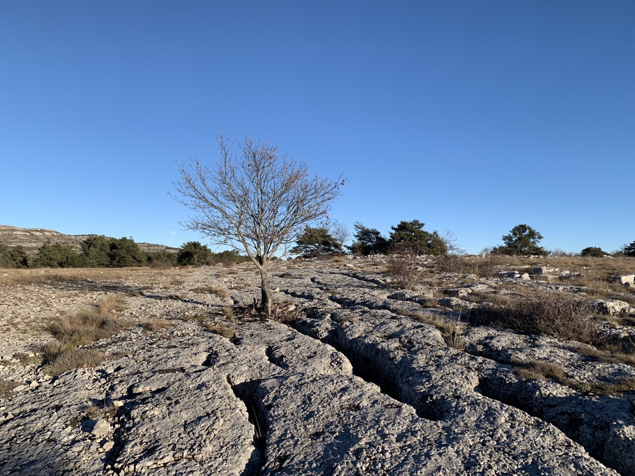
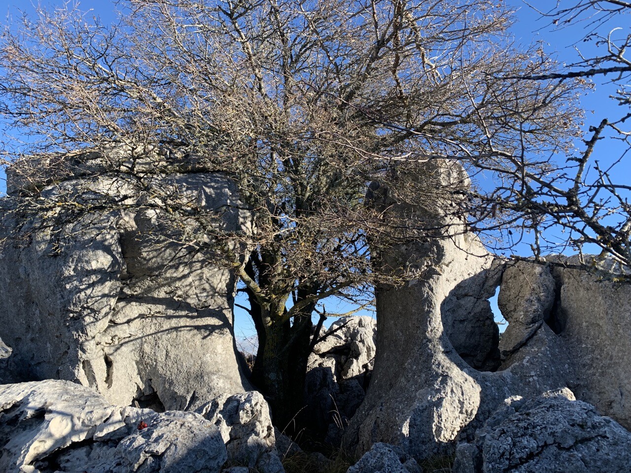
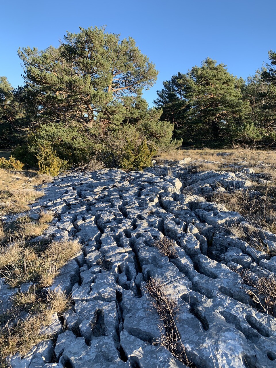
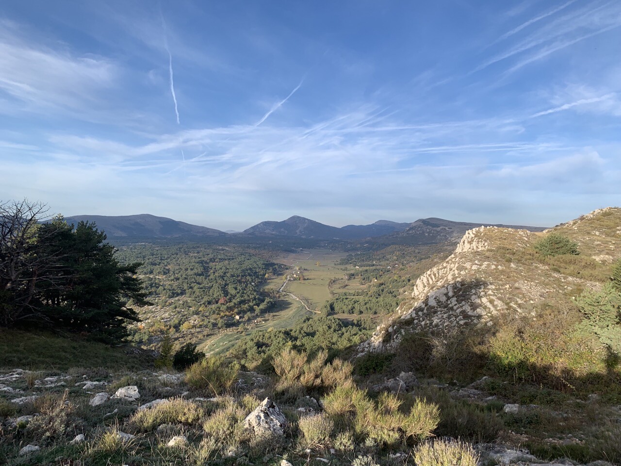
Le plateau de #Caussols, situé au-dessus de #Grasse, c’est un spot de #biodiversité (vipère d’Orsini, fritillaires,…) mais aussi une richesse #géologique : vaste poljé et multiple formations karstique. #nature #naturephotography #geology #cotedazur #AlpesMartimes
Anthony Lomax
boosted

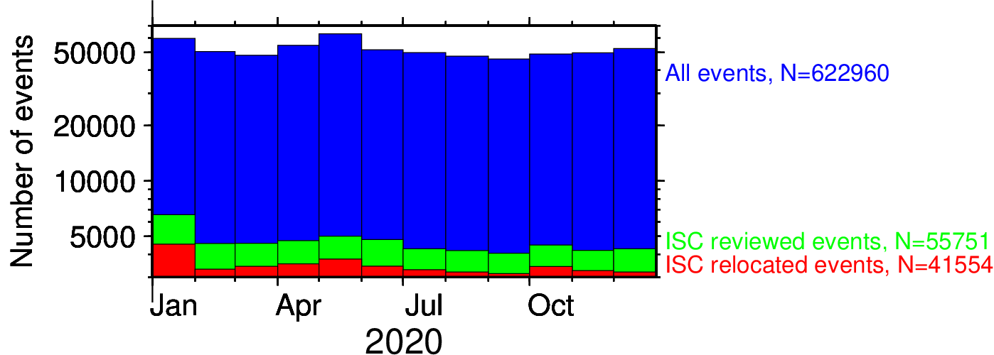
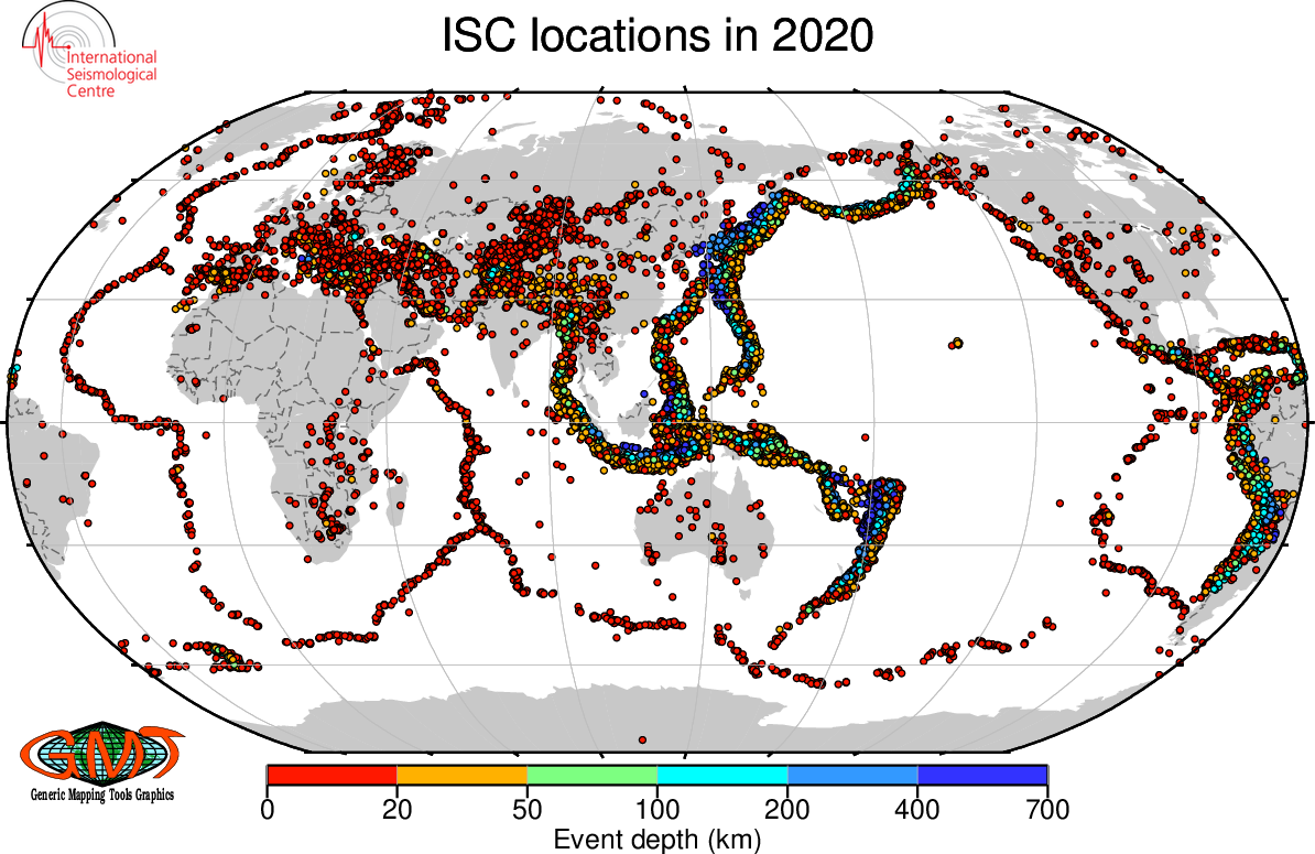
Another year reviewed by the ISC: the plots show the 2020 ISC #locations and the number of collected (blue), reviewed (green) and relocated (red) events per month. For year 2020 the ISC collected data for 622,960 events, reviewed 55,751 and relocated 41,554 of them, using & reviewing nearly 7 million seismic phases!
Anthony Lomax
boosted


Anthony Lomax
boosted
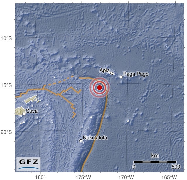
M 6.5, Tonga Islands
2022-12-04 19:24:13 -15.46 -173.10 10 km A
http://geofon.gfz-potsdam.de/eqinfo/event.php?from=rss&id=gfz2022xtey
Anthony Lomax
boosted
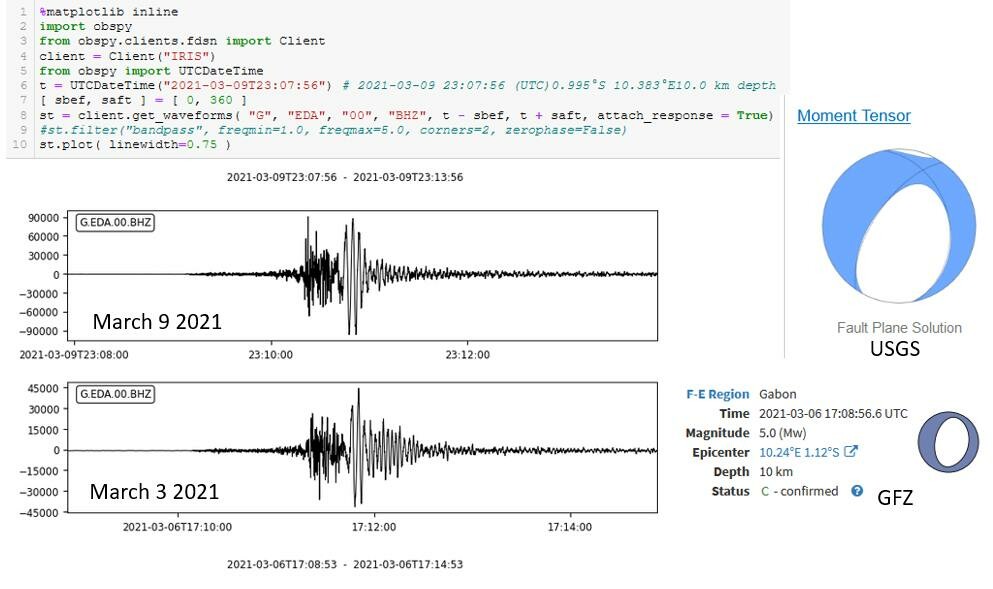
These are the signals on the same station for the earthquakes in 2021 together with the USGS focal mechanism (that I posted on Twitter way back when).
The seismic signals are like fingerprints and you get a sense of deja vu when you see them again.
Anthony Lomax
boosted
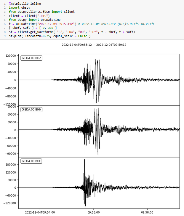
Magnitude 5.5 #earthquake in #Gabon 30 minutes ago (2022-12-04Z09:53).
Signal on station G.EDA (courtesy of the #GEOSCOPE global #seismic network and made available via #IRIS) - displayed using @obspy software. There were two very similar events here in March 2021 but today's is larger. https://earthquake.usgs.gov/earthquakes/eventpage/us6000j6u0/executive
Anthony Lomax
boosted

IPGP #SCARDEC solution for today unusual Mw 5.6 #earthquake in #Gabon. Relatively shallow normal faulting. http://geoscope.ipgp.fr/scripts/seismes/fiche.php?seis=us6000j6u0 http://geoscope.ipgp.fr/seismes/events/2022/us6000j6u0/carte.jpg
#Earthquake happenings+tidbits, maps, #MachineLearning... I'm ALomax Scientific: earthquake monitoring and analysis.
"seismicity is only the edges and shadows of complex, 3D space-time tectonic processes"
Car free for daily life since 1976.
Joined Nov 2022
