

Steve Zissou @SteveZissou@qoto.org
Steve Zissou
boosted

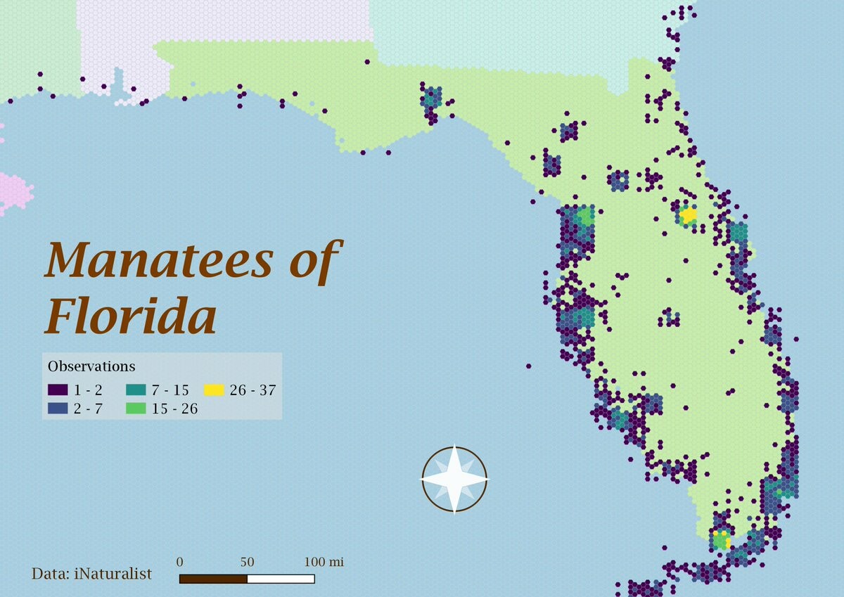
Today is hexagon day for the #30DayMapChallenge. Excited to head down to see family in Orlando next week for Thanksgiving and hoping we can fit in some manatee viewing time.
Steve Zissou
boosted

Steve Zissou
boosted

If disaster does not strike, on Friday we are launching the largest houseboat ever to float on the Loire river. This is a very accurate drawing of what it looks like. Photos will follow - we hope.
@starfleetjobs So ... a space barista?
Steve Zissou
boosted

#30DayMapChallenge
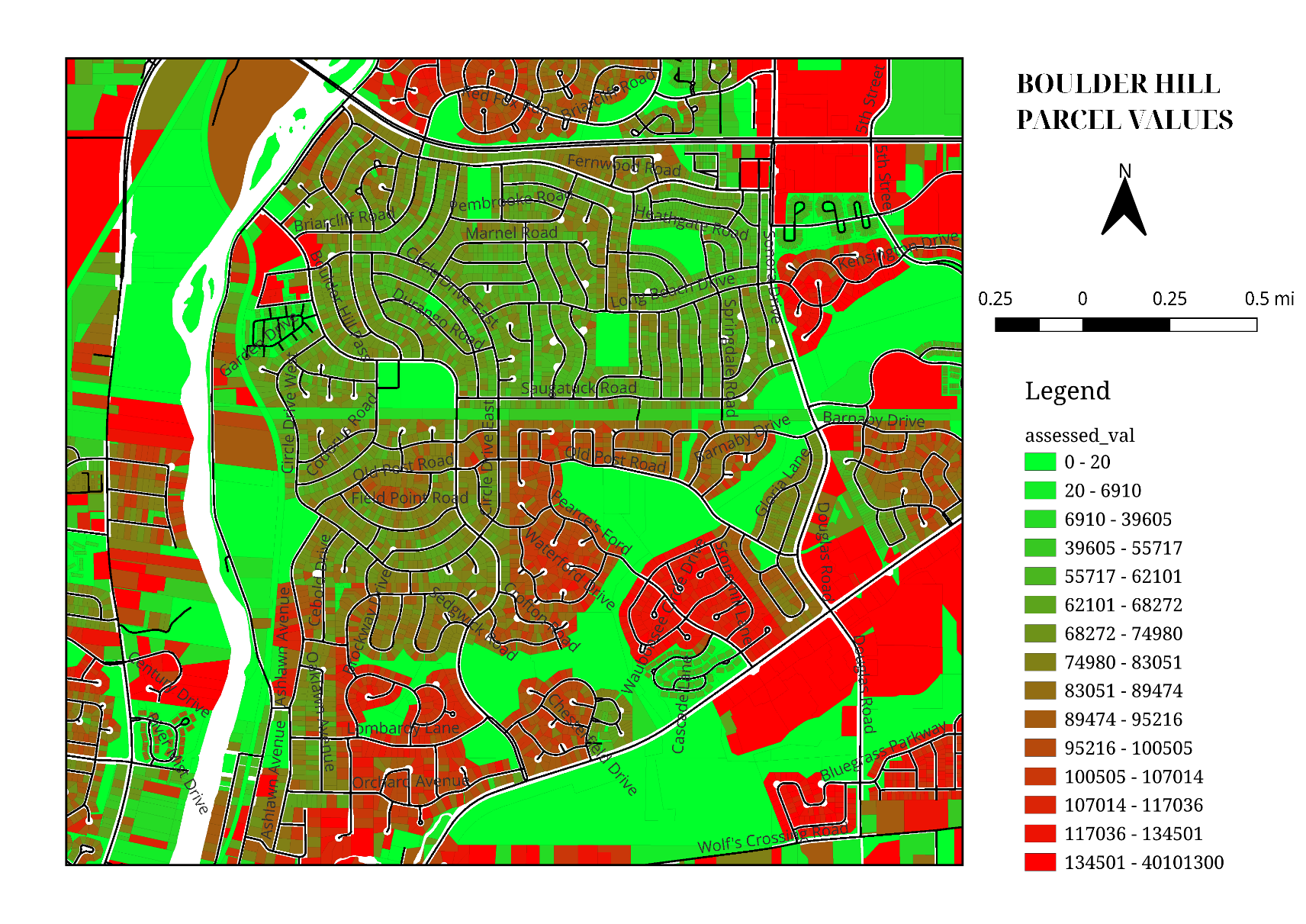
Day 10 - Bad Maps
Tried to shoehorn as much bad as I can in one map. While nothing "in the wild" goes this far, too many of these attributes are still easy enough to find.
- Colorblind-unfriendly color scheme
- Too many symbol classes
- Numeric attribute visualized on polygons
- North arrow and scalebar for a non-navigation map
- Parallel street labels with no halo
And it pains me to admit it, but the streets come from #OpenStreetMap, and I didn't provide attribution. Bad!
Steve Zissou
boosted

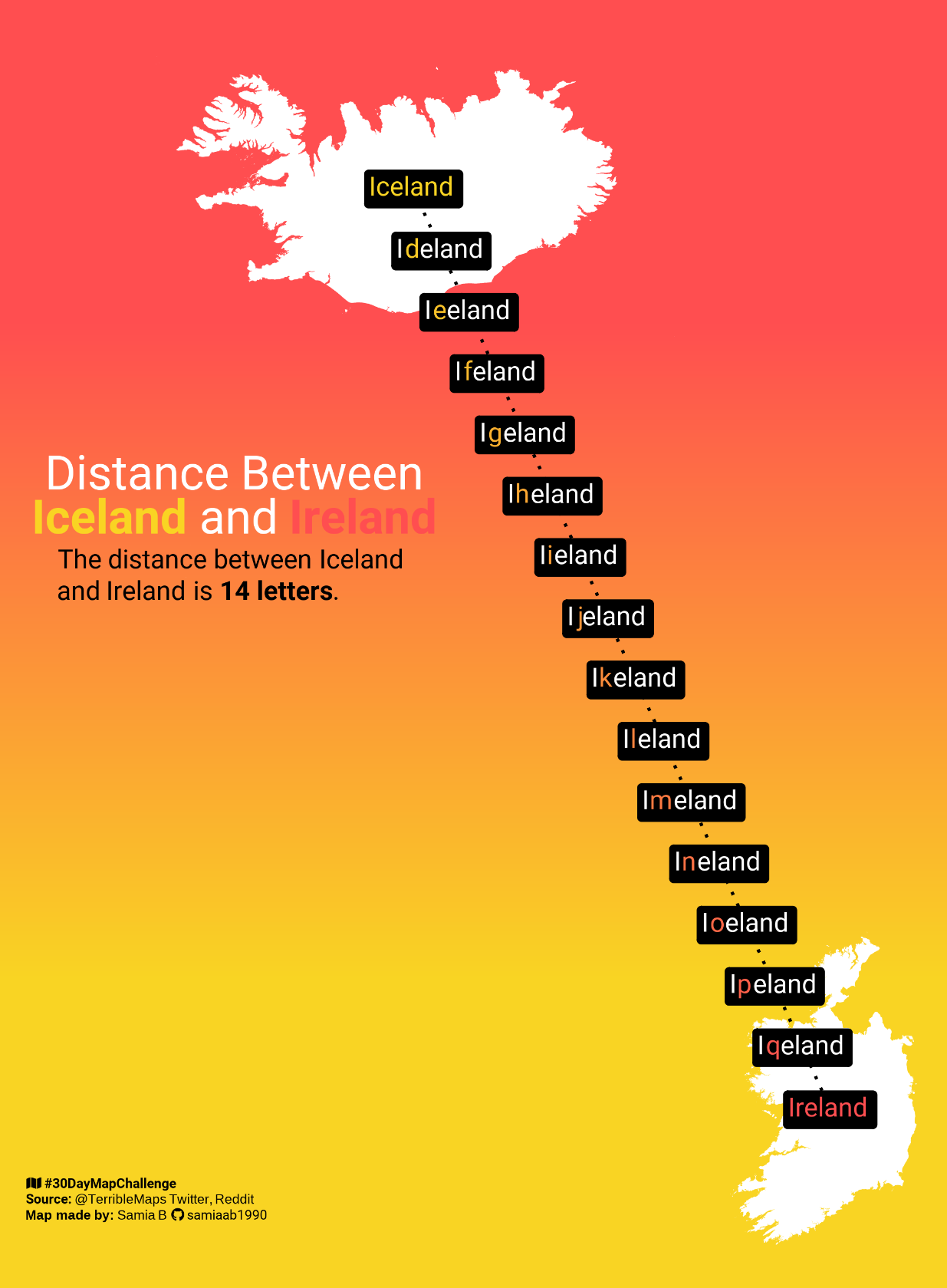
#30DayMapChallenge
Day 10: A bad map
Inspired by
@TerribleMaps
Made using #RStats
#dataviz #DataVisualization #maps #GIS
Steve Zissou
boosted

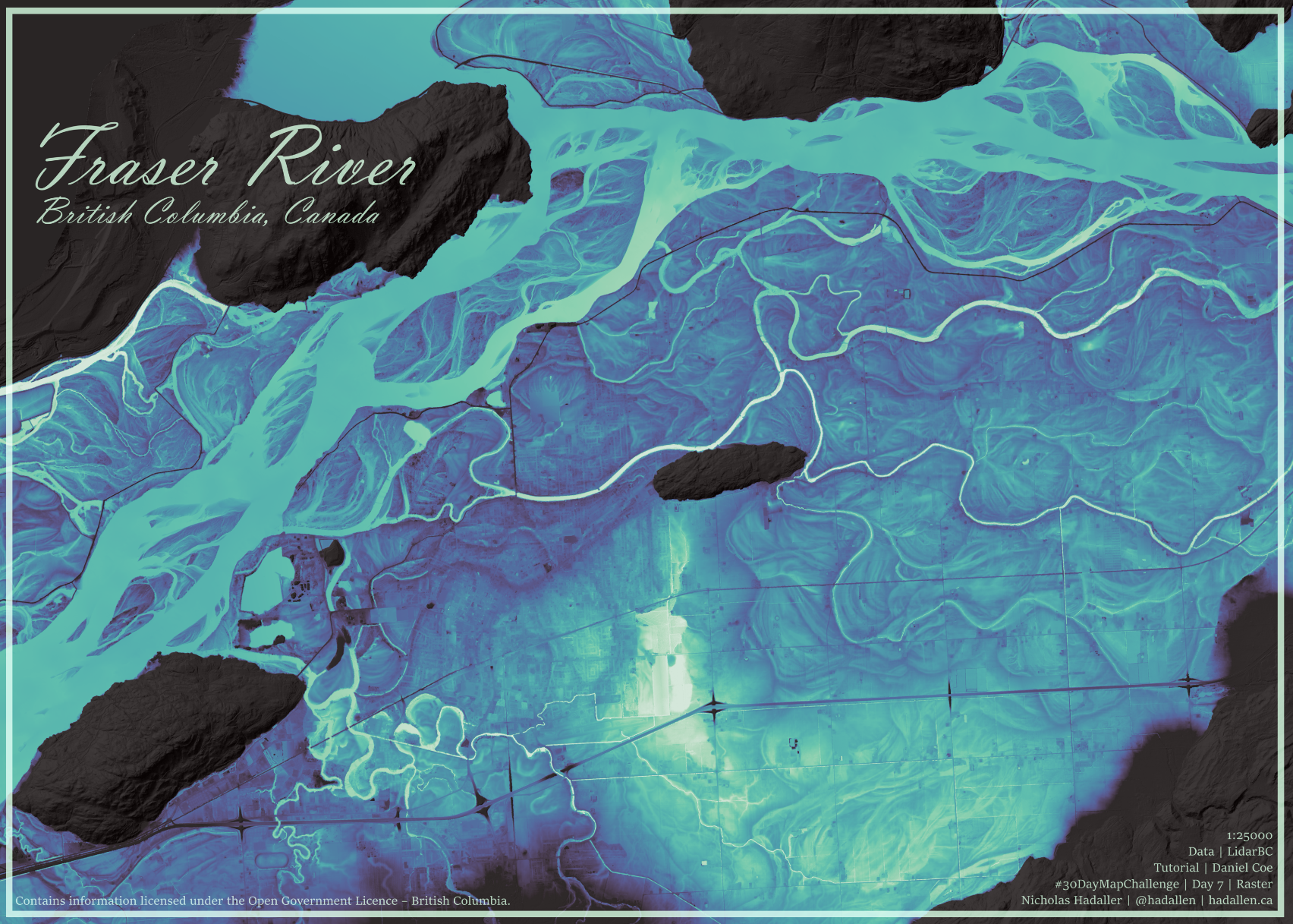
#30DayMapChallenge - Day 7 - Raster
I've been wanting to try following Daniel Coe's REM tutorial for awhile now - Figured this is the best time to try! I couldn't get mine as pretty as his though!
@DataScienceNot2 "suspiciously handle" ![]()
@megueyb Eat them. It's a new dieting fad.
Steve Zissou
boosted

#30DayMapChallenge day 9: Space
A moon shaped lunar relief map
Steve Zissou
boosted

#30DayMapChallenge / day 12: "scales"
French « départements » at the same size but tidily ordered by area.
Steve Zissou
boosted
#30DayMapChallenge / day 13: "5 minutes map"
Sugar cane fields in La Réunion
Steve Zissou
boosted

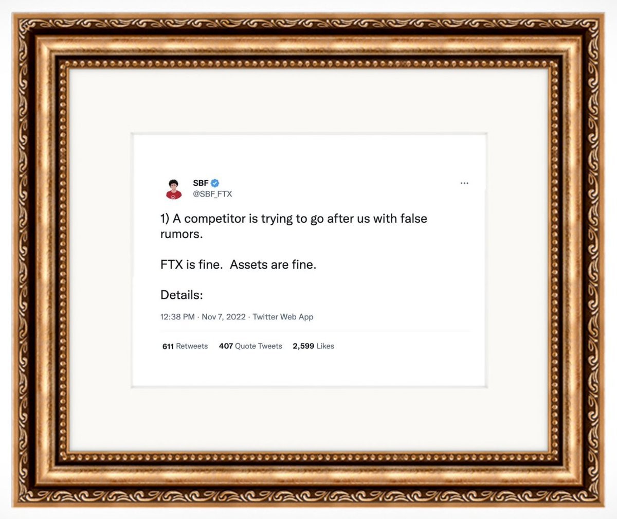
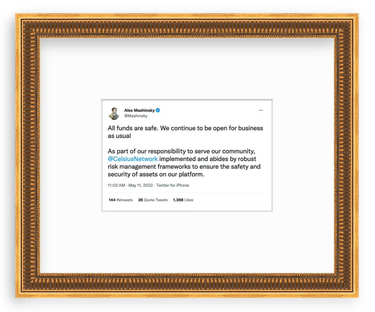
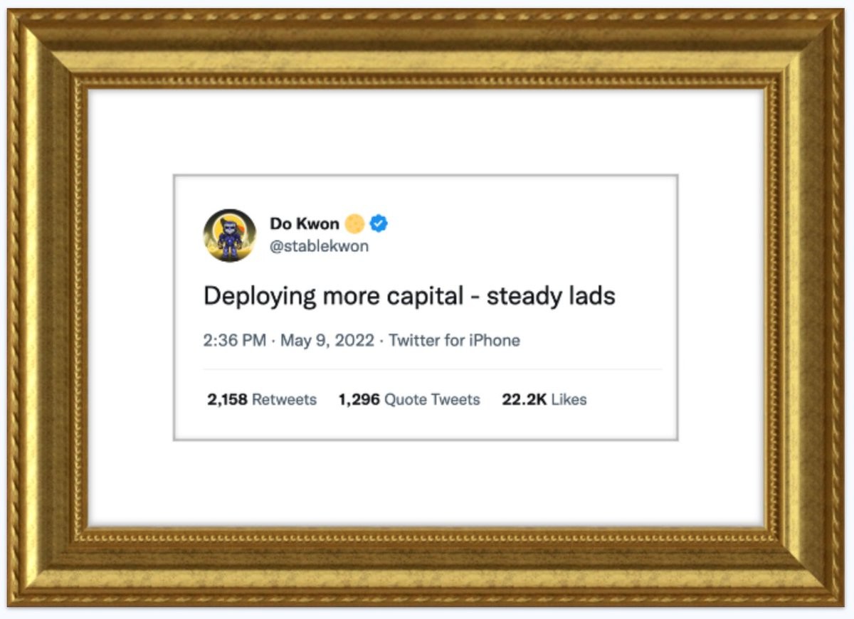
Not your keys not your coins
Steve Zissou
boosted

Is anyone else having a really bad dwarf infestation this fall? I swear, it gets cold and the little devils come swarming into the cave. It wouldn't be so bad if I hadn't already eaten enough them to give me indigestion. I suppose I could try canning…
Steve Zissou
boosted

Musk claiming that a lot more people are engaging on Twitter is like me claiming that a lot more people are stopping by to look at my new house after I set it on fire.

Steve Zissou
boosted

Steve Zissou
boosted

Steve Zissou
boosted

Just got a msg saying that Google are 'sunsetting' an analytics function. What an utterly bloody pointless bit of euphemism! I mean, sure, lie to the kids about where the hamster ended up but do we *really* need to be protected from the wrenching emotional impact of a bit of code going out of date.
Admit it, Google. You took it down to the end of the paddock with the shotgun and a shovel.
Steve Zissou
boosted

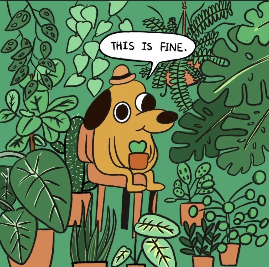
Initial impression of Mastodon…
(image source thanks to @jsit: https://www.instagram.com/p/CKrqzp-F420/)
