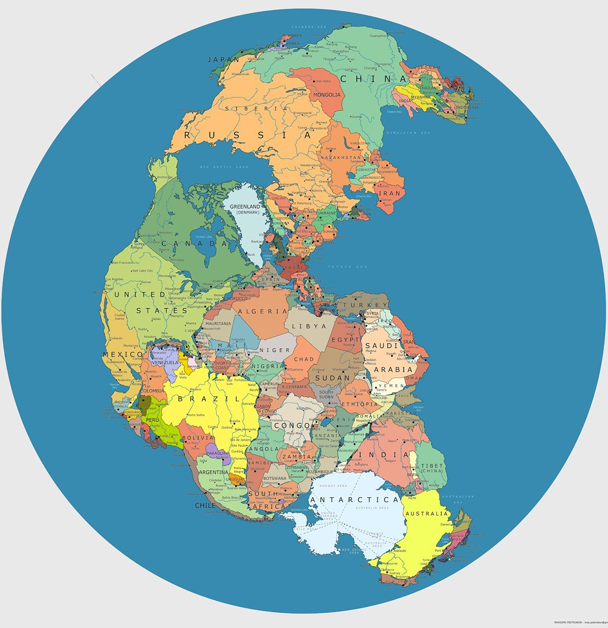
Over the last century, there have been a few waves of what I guess I'd call *counterintuitive #cartography*. Jaded as I am, when I see examples go by on social media and the web, my first response is less about whatever factoid is being revealed ("DID YOU KNOW MAINE IS REALLY SOUTH OF TEXAS?!") than how and why the last several years have seen another wave of interest in this kind of revelation. (Naturally, I have some theories about that... 🌞). But this example is unusual and (imo) pretty great. 🎩 to @metamute, more or less.


@nonesuch_user I couldn't say, really — both? In some ways it looks like it was ~p'shopped, but in others that its composition was automated.