Follow

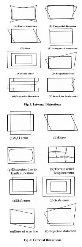
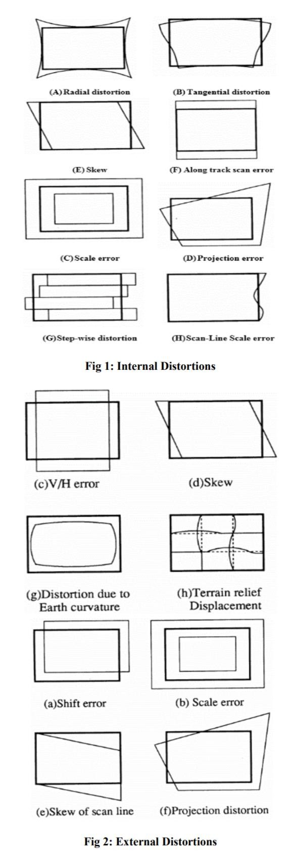
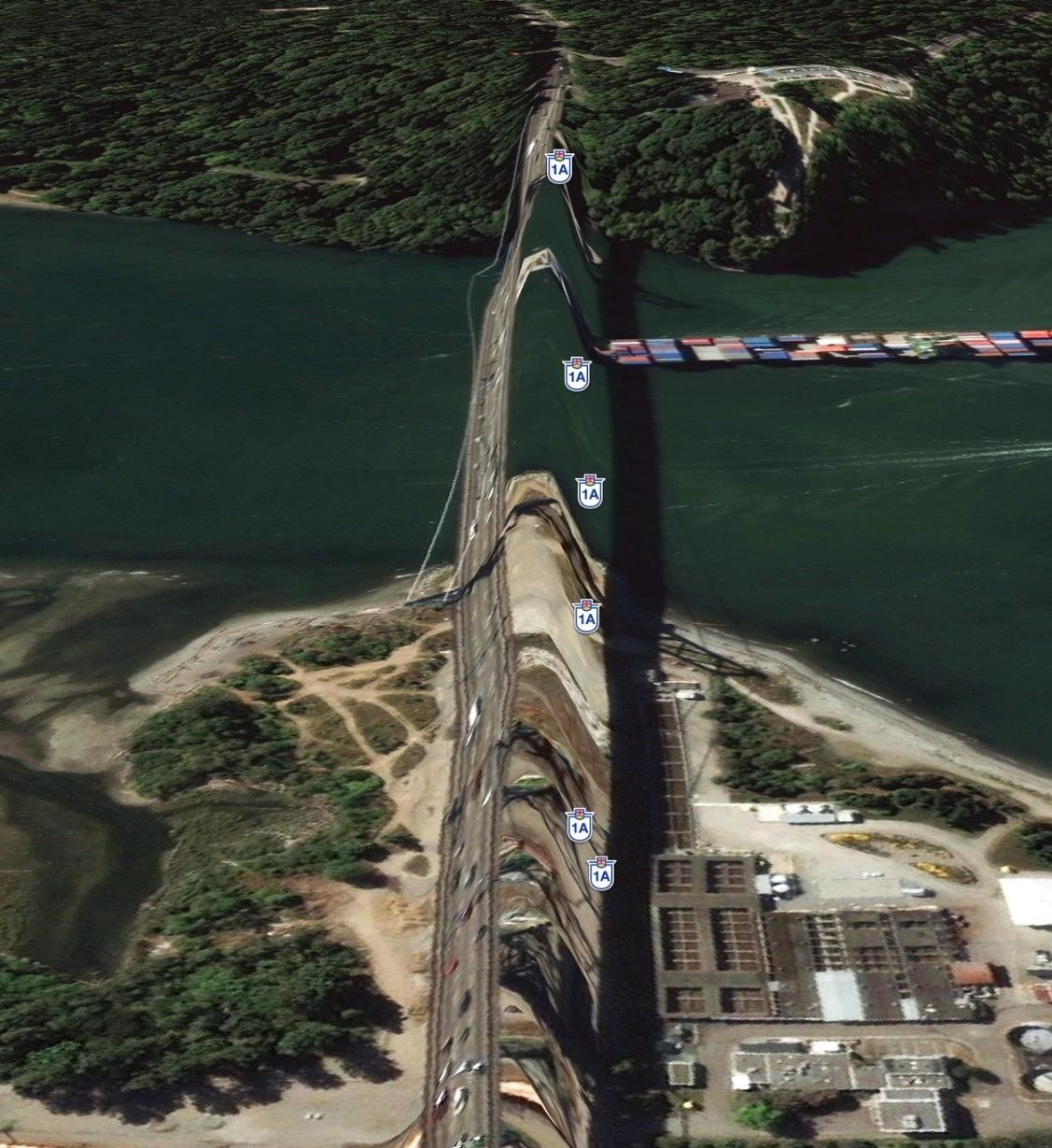
<a href="?q=%23%E4%B8%8D%E8%A9%B2%E5%86%B7%E7%9A%84%E5%86%B7%E7%9F%A5%E8%AD%98">#不該冷的冷知識</a><br>在查看衛星地圖時,我們經常發現「驚悚」的地面景物扭曲變形。此類情況可以用專業術語GD:Geometric Distortion來形容。產生扭曲的原因很多:衛星自身運動、設備誤差、大氣干擾、光線折射、後期拼接都可能產生嚴重的圖像扭曲(形狀細長,與地面又有較大高度差的橋樑大壩是GD重災區) <a href="" target="_blank" rel="noopener"></a> <a href="https://twitter.com/Dolltator/status/1148367720905367553" target="_blank" rel="noopener">https://twitter.com/Dolltator/status/1148367720905367553</a><br><br>
