

Steve Zissou @SteveZissou@qoto.org
Steve Zissou
boosted

HOT OLDER MEN in YOUR AREA want to know if YOU have been TOUCHING the THERMOSTAT.
Steve Zissou
boosted

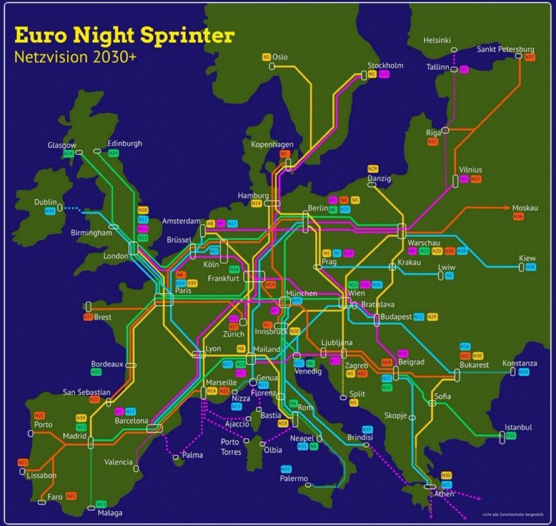
"The Night Sprinter network would be a European grid of night trains that would consist of 40 international long-distance lines. By 2030, it would connect more than 200 cities from #Lisbon to #Helsinki."
Part of the "flight-free movement" growing across Europe.
Aspirational map put together by Greens in#Germany. Still lots of challenges remain crossing borders!
Steve Zissou
boosted

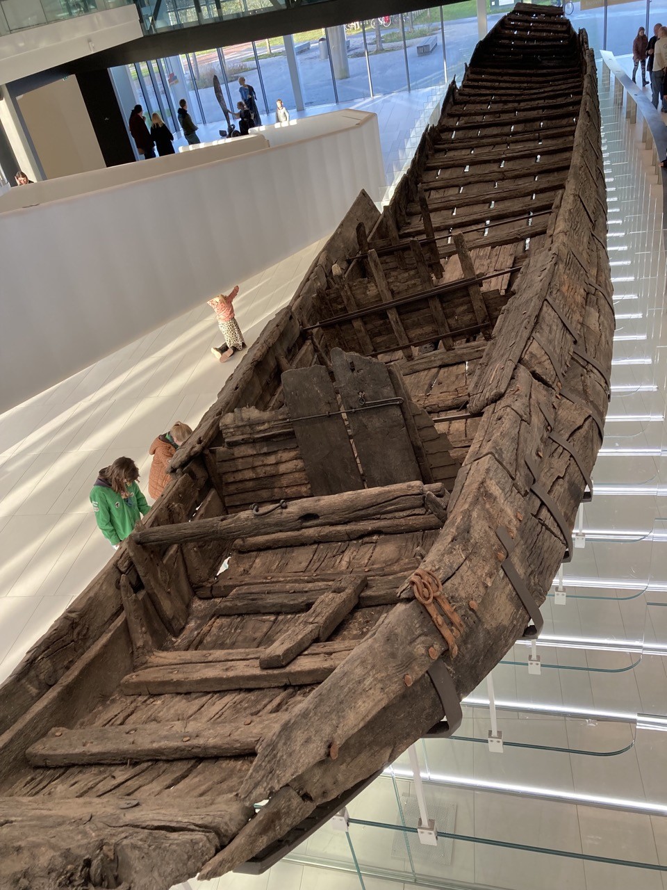
This is De Meern 1, the most complete #Roman river #craft (in this case, a #barge) found in Northern Europe. It sank suddenly & accidentally in about 190 AD, just to the west of Utrecht - the captain may have made a mistake in taking it into a winding tributary of the #Rhine (then the Empire's northern frontier) where he was, it seems, unable to avoid some lethal obstacle. He & the crew seem to have escaped leaving personal belongings which survived with the #boat.
Steve Zissou
boosted

Here is a lazy version of the #30DayMapchallenge 2022 Days
21: @KonturInc population.
24: Fantasy: I air brushed in #Wakanda (just watched #BlackPanther). Can you find it?
25: Two colors. I remember this redish sand tint from my last trip to #Accra, Ghana.
Made w #Aerialod
Steve Zissou
boosted

Steve Zissou
boosted

One week until I will be speaking at @rstatsdc on "Building an Entire City in R: Interactive 3D Data Visualization with #Rayrender"
I'll show how to build a digital replica of a city entirely in R and an example of telling a data-driven story within it!
Steve Zissou
boosted

One of the things I keep hearing here, over and over, is that "new" people on this platform shouldn't complain about things they find confusing or that don't meet their needs.
That's exactly wrong. New uses, who've not yet adapted themselves to possibly unworkable or inscrutable interfaces and limitations, are often in a unique position to have insights that old hands can no longer see.
Perhaps you're tired of hearing the same complaints over and over. But think about why people make them.
Steve Zissou
boosted

Free game on GOG: Terroir. Manage your own vineyard and create the finest wines.
Steve Zissou
boosted

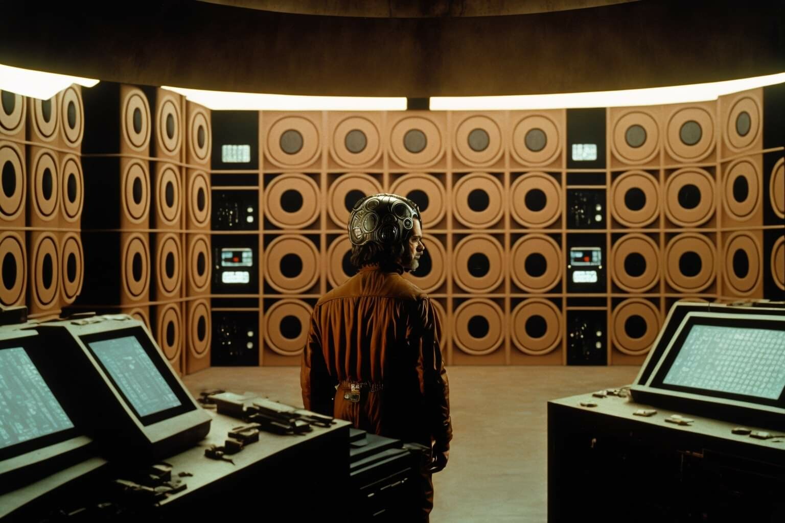
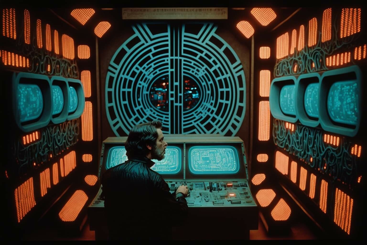
Seen on a Midjourney group in Zuck’s Mall: stills from Alejandro Jodorowsky’s version of TRON:
(1/?)
Steve Zissou
boosted

Crystal Tetrahedron (2020) https://www.shadertoy.com/view/WsBfWt
Steve Zissou
boosted

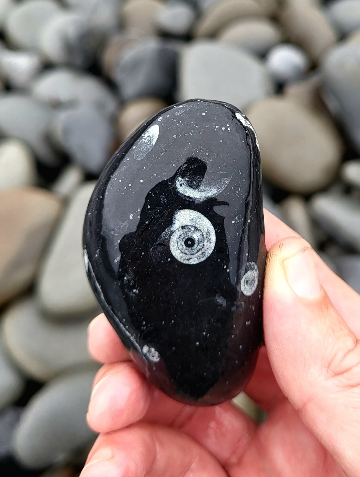
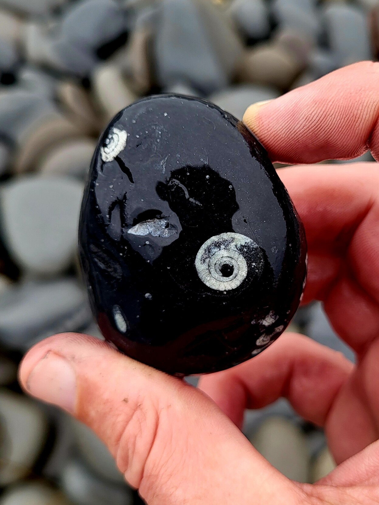
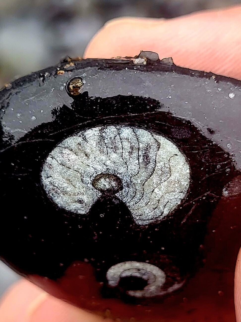
Goniatite fossils peeking out from pebbles- seeing daylight after being buried in layers of sediment for more than 300 million years.
Cliffs of Moher, County Clare, Ireland.
Cormacscoast.com Walking tours
#wildatlanticway #walkingtours #discoverireland #keepdiscovering #failteireland #cliffsofmoher #burrenandcliffsofmohergeopark #atlanticgeoparks #fossils #irishfossils #Goniatite #geology #Ireland #irelandtravel
Steve Zissou
boosted

Steve Zissou
boosted

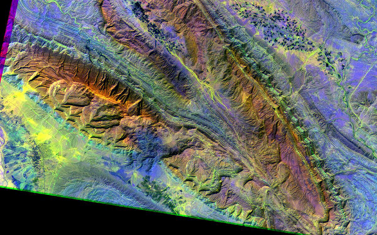
An #ASTER image of the Zagros Mts in Fars, #Iran, because #FridayFold and #Geology rules!
And sorry, I can't remember the band combination I used… It's an old composition, but it's false colour, that's for sure 😅
It represents shortwave #infrared and near infrared light, combined as red, green and blue. The colours highlight different rock types that would be "invisible" to the naked eye. It's perhaps 30 km wide.
Amazing #folds
Steve Zissou
boosted

Steve Zissou
boosted

hey did you know the roots of a cubic polynomial can be visualized using an equilateral triangle?
🔵 vertices are roots
🔴 the incenter is the inflection point
🟢 the incircle boundaries are the local minima/maxima
Steve Zissou
boosted

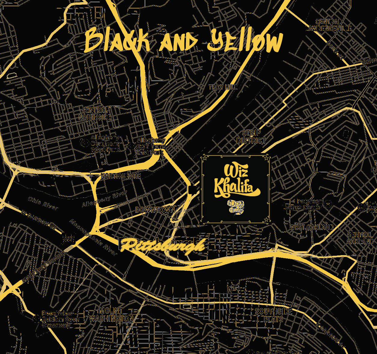
For today's two color #30DayMapChallenge here is "Black and Yellow", Wiz Khalifa's tribute to his hometown, Pittsburgh. Also home of #nacis 2023
Steve Zissou
boosted

STARFLEET SECURITY WARNING
Abort code exposed: Cornwell-Phi-Mu-Epsilon-Yellow-Daystar-Five-Four.
Immediate revocation required.
#StarfleetSecurity #KeepStarfleetSecure #StarfleetInfoSec #StarTrek
Steve Zissou
boosted

Steve Zissou
boosted

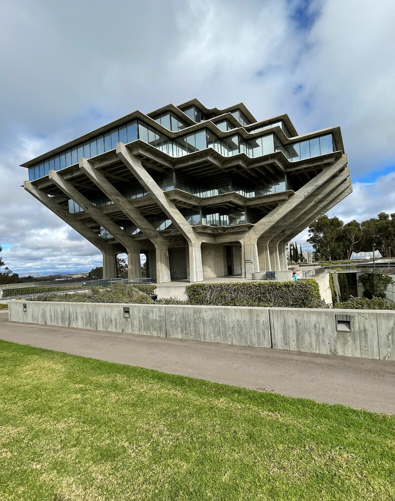
That moment when you encounter a building that is a constant on your bucket list #brutalist #architecture
Steve Zissou
boosted

After a couple of days of Norwegian Geospatial tech conference I see that:
1. OCG Apis are all the rage in the Norwegian Mapping Agency and related organizations
2. Ai for building detection is better when trained on local data than US data from esri
3. People are not dismissive of the idea of distributing changes to geospatial datasets as events
4. Open Source is an integral part of every organisation, some are even sponsoring development
