

commonchaffinch @commonchaffinch@qoto.org
English/中文
Environmental scientist looking at global ecohydrological change using data analysis and modeling tools.
Joined May 2022
Pinned post
Pinned post
Pinned post
Processed some geospatial data today. There was an index that had one entry in my left, geopandas dataframe, and twelve entries in my right, ordinary pandas dataframe. After joining, there were 1236 entries under that index!
Solved the problem by writing the code in a different way but still scratching my head on the issue.
As a person with mild dyslexia, I dearly wish all the scientific journals could switch to sans serif font for their PDFs.
commonchaffinch
boosted

I'm finding it a little hard to work today with this in my head.
Antarctic ice extent is now 6.4 standard deviations below the mean. That is, I'm reliably told, a one in 13 billion year event.
We're about to see a lot of shit hit a lot of fans. And we are far from ready.
Business as usual is over. Politics as usual is over. We need to be putting our effort into building systems that can help us survive what greed and power and wilful blindness have wrought.

Reading a paper this morning and saw two graphs that demonstrates how powerful the ocean currents are in shaping the climate. The Gulf of Alaska and the western part of high-latitude Eurasia are both next to warm currents. They both experience higher precipitation than the eastern parts of the respective continents, and have virtually nowhere with average temperature below 1 degree Celsius in winter.
(images from internet and the paper below)
https://agupubs.onlinelibrary.wiley.com/doi/10.1002/2015JD024546


commonchaffinch
boosted

I'm beginning to see where the comparative advantage is between myself and current-generation #AI tools.
For tasks that I perform on a daily basis, I have developed enough techniques to optimise my workflow that AI tools don't add much for me. Most obviously with regards to research mathematics, but also for instance in composing emails; I installed a plugin that lets GPT4 write email responses for me at the click of a button, but I almost never use it, because I already can write suitable email responses rapidly through decades of practice.
For tasks that I have some expertise in, but little practice, AI tools are helpful: often I can use them profitably to create a first draft of the output, which I can then verify and polish, or at least use as inspiration. (In some cases the inspiration is due to deficiencies in the AI product, in the spirit of Cunningham's law, but it can still be a more productive process than if I tried to work things out on my own). Examples in this category include data processing, translating to a foreign language, or writing text in a format that I rarely use (e.g., a public speech, a rules document, etc.)
For tasks that I have little expertise in, and do not require extremely high quality and reliable output, one can simply ask the AI tool and follow its advice more or less blindly. Here the AI functions as a slightly more convenient version of a traditional search engine.
Finally, for tasks that I do not have expertise in, but for which quality and reliability are needed, neither the AI or myself can resolve the task, and I have to consult a human expert. An example would be a repair of a complicated, expensive, and delicate piece of equipment.
commonchaffinch
boosted

RT @ESA_EO
To achieve food security for all we need to know which crops are growing where and how

Launching today, @ESA_WorldCereal provides highly accurate seasonally updated cropland and crop-type maps at 10-metre spatial resolution at a global scale: https://www.esa.int/Applications/Observing_the_Earth/Introducing_World_Cereal
GIF
commonchaffinch
boosted

You have to read this fascinating obituary of the brilliant woman who invented multi spectral satellite imaging for LandSat and defined the way we now understand spaceborne mapping imagery of Earth
commonchaffinch
boosted

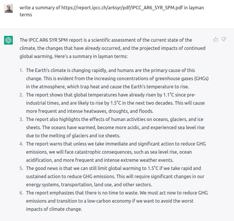
@stworg @rahmstorf @johnfocook @MichaelEMann of course, chatGPT doesn’t actually access URLs (https://simonwillison.net/2023/Mar/10/chatgpt-internet-access/ ) and has never actually seen the report.. nevertheless a good summary which perhaps speaks to the fact that we as a society should have been prepared for this for some time

commonchaffinch
boosted

How ChatGPT summarizes the latest climate report by the #IPCC!
---
RT @stworg
chatGPT rocks -- arguably does a better job than IPCC https://www.realclimate.org/index.php/archives/2023/04/the-summary-for-policymakers-of-the-intergovernmental-panel-on-climate-change-sixth-assessment-reports-synthesis/ @SciBeh @MichaelEMann @NaomiOreskes @johnfocook @RasmusBenestad @Sander_vdLinden @MaibachEd
https://twitter.com/STWorg/status/1644604195599790083
commonchaffinch
boosted

Aerial image of a forming thermokarst lake in western #Alaska. Ice wedges in the ground are melting, the ground is sinking/subsiding and water is ponding in the newly formed depressions. This process will likely continue and accelerate and eventually form a #lake
The image is around 370m wide and taken from about 1000m altitude in one of our flight campaigns in 2021.
164.535°W; 66.532 °N
#aerial #aviation #eochat #landscape #remotesensing #earthart #science #permafrost #arctic #geography

commonchaffinch
boosted

10 days after the toxic train derailment in East Palestine, Ohio, officials insist the air is OK to breathe, despite it continuing to make some people sick.
And don't drink the water, officials now say, changing their story from the initial claims there was no water pollution. 3500 dead fish beg to differ & a contaminant plume moving down the Ohio River beg to differ.
https://www.washingtonpost.com/climate-environment/2023/02/14/ohio-train-derailment-toxic-chemicals/
#Risk #Pollution #EastPalestine #Ohio #train #derailment #AirQuality #WaterQuality
I wish all the university email systems can send a "this email no longer exists" notice to anything sent to an deactivated email address. Since leaving my last job, I have missed quite a few emails from collaborators.
commonchaffinch
boosted

UH GEO Professor Qi Chen is the P.I. of HawaiiView, a nonprofit organization to promote remote sensing data and technology in Hawaiʻi. HawaiiView recently released the first statewidemap of Uluhe with Landsat-8, hawaiiview.org/data/uluhel8/.
commonchaffinch
boosted

A friend got this as a #Springer #journal #editor. I expect it will work about as well as #plagiarism detection #software generally does. Maybe worse, since journal writing in particular is known for forcing human* authors into a very mechanical #writing #style. There may be nothing easier to mimic for #ChatGPT et al.
*Presumably.

commonchaffinch
boosted

It turns out that while #JWST is sort of like your phone’s camera, making images with a 10 billion dollar telescope designed for science observations is a little more tricky than point and shoot.
More about the image processing process:
https://webbtelescope.org/contents/articles/how-are-webbs-full-color-images-made

In the past couple days, I had to delineate a watershed using the PCRaster tool for some hydrological modeling work. Despite the excellent tutorial of https://github.com/jvdkwast/PCRasterTutorials/tree/main/PCRasterCatchmentDelineation, there were several pitfalls that took me a long while to figure out.
The first is, how do I know what x-y coordinates to put into "location.txt"? I only know the latitude and longitude of my stream gauge, but they did not work when I tried putting them in. It turns out the x-y coordinates are the coordinates of this stream gauge in the projected coordinate system of the flow direction (ldd) map. As such, the easiest way to approach the problem seems to be to use the QGIS PCRaster plugin. First, import the digital elevation map into QGIS, reproject it into a projected coordinate system, and set the layer's coordinate system to be the same as the digital elevation map. Second, calculate the ldd map using the PCRaster plugin's `lddcreate` command, so that the ldd map has the same projected coordinate system. Third, load the text file containing the lat-lon of the stream gauge as a map layer. QGIS automatically does the conversion, so that the gauge is shown in its correct position in the projected coordinate system. Fourth, calculate the stream order from the ldd map using the PCRaster plugin's `streamorder` command and check if the gauge is actually located in the correct stream. This is important because the lat-lon coordinates and the digital elevation maps are not entirely accurate, often causing the gauge to be outside the stream implied by the ldd map. If the gauge is outside, find the nearest in-stream pixel that seems to make sense. Placing the curser on top of the nearest in-stream pixel finally makes QGIS show the desired x-y coordinates in its status bar.
The second is, how to install the PCRaster plugin in QGIS? The plugin does not work on its own. Instead, one must install PCRaster in the same Python environment as QGIS accesses. In the end, I had to create a new conda environment and install PCRaster and QGIS both from the `conda-forge` channel. Moreover, the default `conda create -n ` command now pulls Python 3.11, but this Python version does not support compatible PCRaster and QGIS releases. I set the Python version to 3.9 to finally make things work.
The third is, why is my delineated catchment area incorrect? My stream gauge is on a major river so I know it must cover a large catchment area. Yet I got a zero-sized catchment at my first try. It turned out that in running the `lddcreate` command in PCRaster plugin, one must remove pits - pixels that draw flow from all directions and do not let water flow out - that do not make sense. One can set thresholds in the "Outflow depth", "Core area", "Core volume", and "Catchment precipitation" in the options of the `lddcreate` command to remove pits that are too shallow or too small. The default thresholds were too small for me, and as a result, the pits broke up my major river into many small ones in the stream order map created from the ldd map. After I set the Core area to be five times the default 9999999 (map units, for me it was meters), my delineated catchment finally made sense.


commonchaffinch
boosted
Nuclear #fusion will not only come too late to help solve the #climatecrisis. Even in the long run it will not be the unlimited energy source that some are dreaming of. The reason is basic physics, and anyone can do the back-of-envelope calculation.  1/
1/
commonchaffinch
boosted

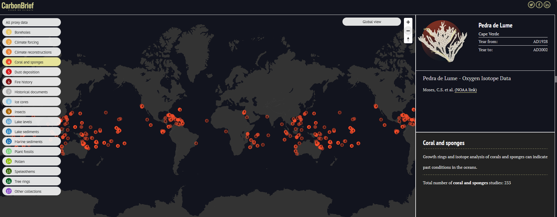
I really love this @carbonbrief compilation led by @hausfath (i believe): https://interactive.carbonbrief.org/how-proxy-data-reveals-climate-of-earths-distant-past/. Really useful to the public and climate scientists like me who need help in compiling data!
commonchaffinch
boosted

I’m seeing more and more #earthscience people joining mastodon everyday. If you are not on the list linked below, please ask to be added by contacting Chris Rowan at @allochthonous The list allows newcomers to quickly follow you by exporting the list and importing it under the Import and Export option under Settings. Thank you, Chris!

English/中文
Environmental scientist looking at global ecohydrological change using data analysis and modeling tools.
Joined May 2022
