

@matrix Does this dude really think this is racially motivated...
Its simple science. Skin color correlates to latitude. Light/white skin is dominate closer to the poles and dark/black skin is dominate closer to the equator.
When you flatten a map locations closer to the poles will be stretched more than things near the equator. So lighter skinned regions will be distorted to look bigger.
@matrix Its a stupid argument.. Dont get me wrong there are maps that correct for land size that have a place if we want something that is somewhat fair in terms of comparing land size, and we do use that. But those severly warp straight lines and thus have their own problems.
There are reasons for the map projections we use and none of it has to do with skin color.
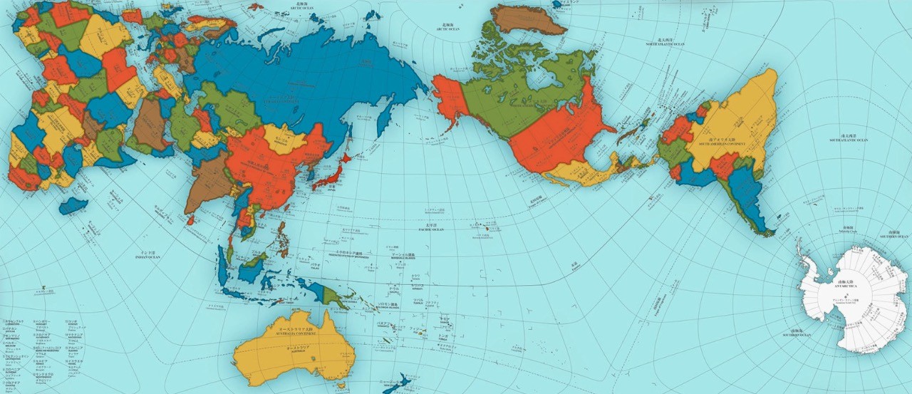
Attached is an Authagraph map projection. It is an example of an equal-area map projection. Notice however how the longitude and latitude lines are no longer straight lines and thus is very inaccurate when it comes to understanding the relative location between points.

@freemo
I remember seeing this argument. It's essentially that it gives more importance to white countries and white people by making them look bigger than they really are.