
🌊 Rescuing tide gauge data from around the #UK to study #climate #change and sea level rise
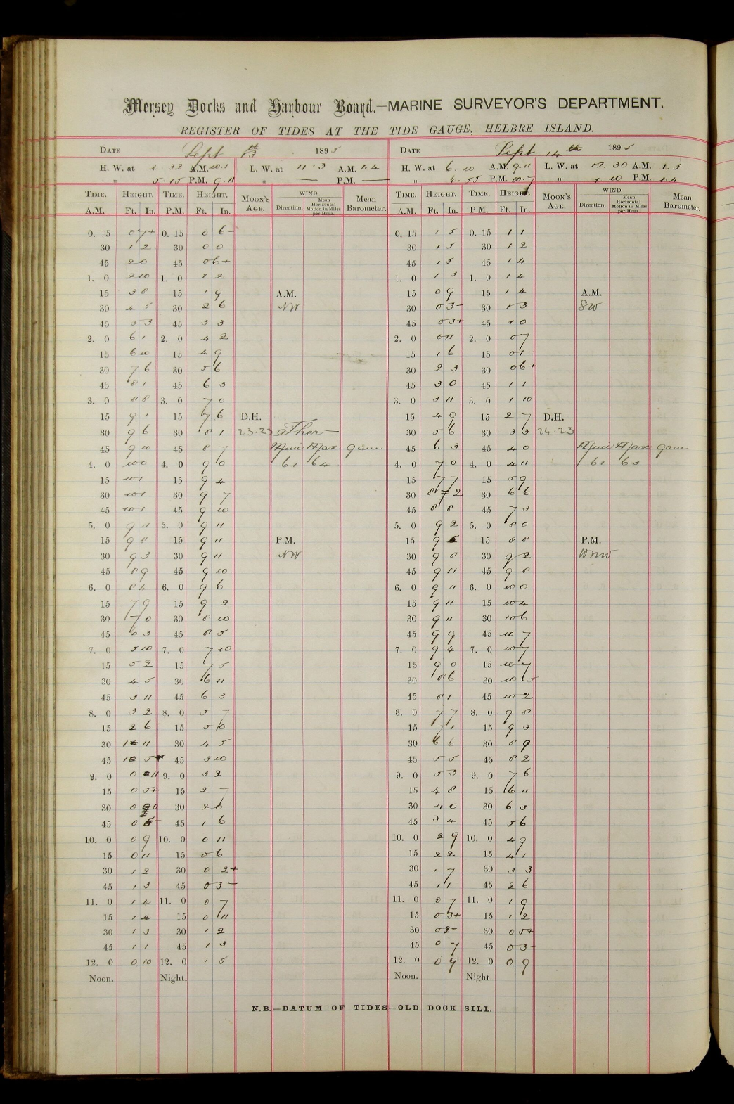
Data is essential for a better understanding of how, why and where the climate is changing. This project starts to digitize historical handwritten records of sea water levels in the UK.
Join today:
https://www.zooniverse.org/projects/psmsl/uk-tides
#science #openscience #CitizenScience #opendata #climatechange #climatecrisis

@openscience how would local tides be effected by local climate change.. wouldnt any effect on the oceans locally (like expansion via warming) just push out and mix with the rest of the ocean and not produce a localized tide effect but rather increase the tides everywhere by an equal amount?

Rising seas by even a few millimeters will affect tides because the scale is massive.
Few 'mm' vertically but imagine how much volume of water caused that, coz its across the entire surface area of the ocean! About 40 trillion cubic meters of extra water causes 2-3 mm of sea level rise.
To check this rise nowadays we have "altimeter" based satellites that operate by bouncing radar signals of the sea and measuring anomalies.
But tide gauge data was the old way of keeping track of any sea rise, whether people knew of climate change or not back then. Hence some statistics on old tide gauge will help understand how fast sea was rising in the 20th century compared to now. One estimate says it was rising at Half the Rate at which it is now.
The Sentinel 6 satellite mission launched in the year end of 2020 aims to continue monitor sea level rise for the next 5 years. Satellites have been monitoring sea rise for last 20 years.
@freemo @openscience
My guess is they are gonna study local tide changes and release a paper specific to UK. Tides are complex and vary worldwide. Hence maybe they want to narrow down the research to avoid any overarching claims on global tides, and keep it specific to their AOI.

@sid_enceladus @freemo@qoto.org
What are we going to do with the data?
The main aim of extending sea level records is to include them in the Permanent Service for Mean Sea Level (PSMSL) dataset, which is then used in the Intergovernmental Panel on Climate Change (IPCC) Assessment Reports. The sea level data set could be used in Meteorological reanalysis and also to constrain operational surge models.
[...]
SOURCE:
https://www.zooniverse.org/projects/psmsl/uk-tides/about/research